


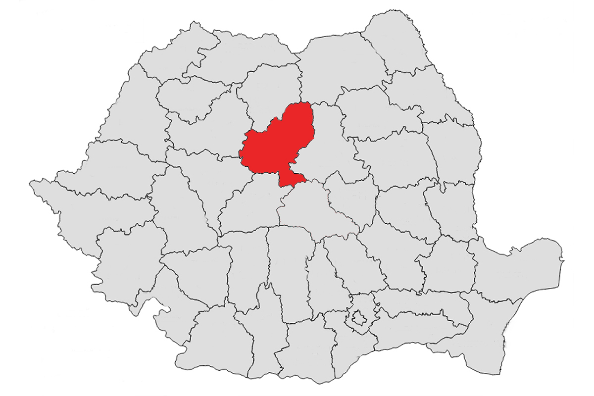
Mureș County (Cities: Targu-Mures, Reghin, Sighisoara)
Mureș is a Romanian county in the historical region of Transylvania with the capital of the Târgu Mureș district. It is named after the Mureș river of the same name, its common abbreviation and license plate are MS. Mureș County borders Bistri ima-Năsăud County to the north and northwest. Moreover, it is bordered to the north by the Suceava district, to the east by the Harghita district, to the south by the Brașov and Sibiu districts, the latter to the west and also to the west by the Alba district.

Tourist attractions / Excursion destinations and Recommendations / Activities

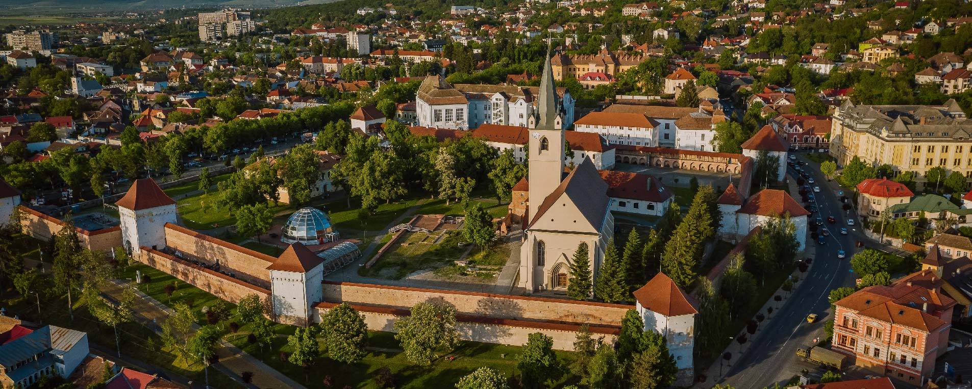
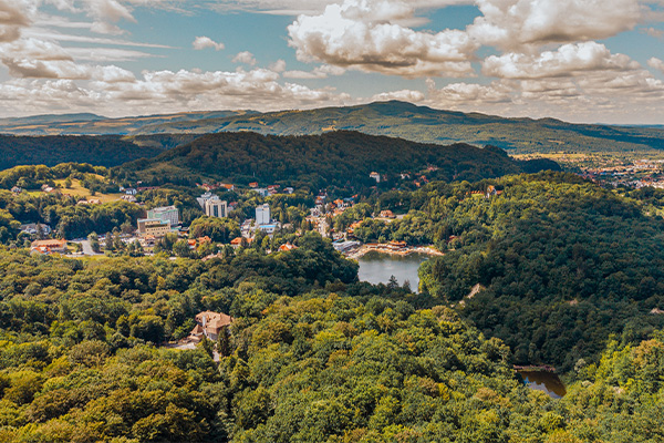
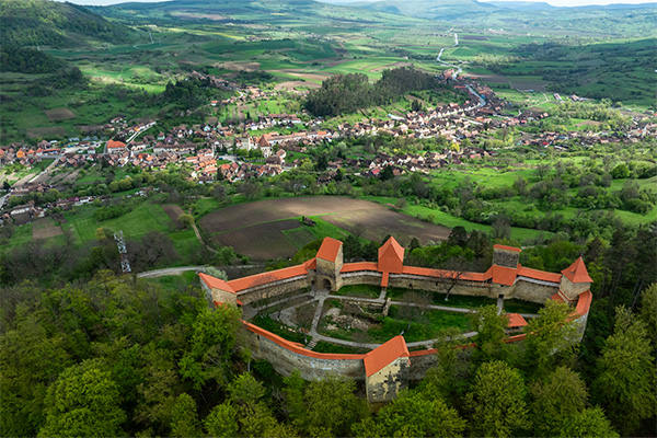
Citadel | Sighisoara City
[More about] [Map]
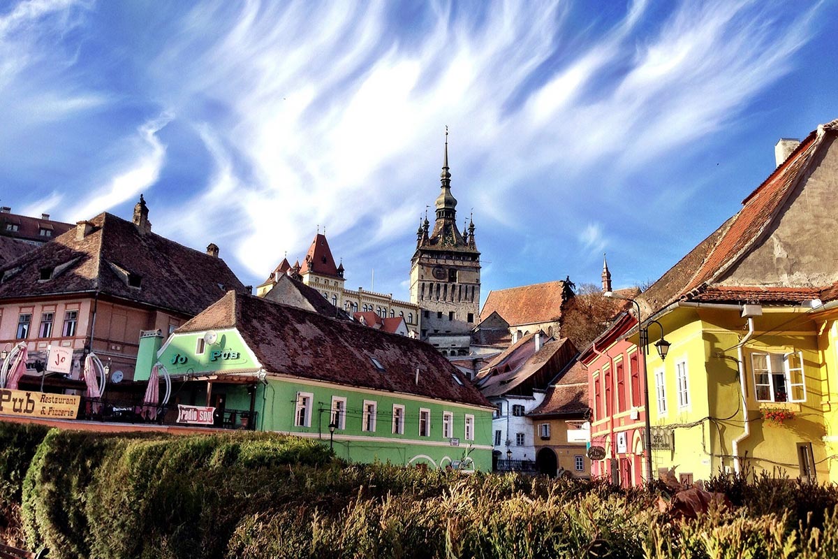
The citadel hill of Sighisoara is the best-preserved medieval town fortress in Transylvania and the largest continuously inhabited medieval fortress in Europe. Built from the 12th century by Saxon colonists, the historic center remains almost unchanged. A defensive system of 930 m walls with 14 towers and bastions was built in the 14th-15th centuries, with guild contributions. Today it features cobbled streets, pastel houses, historic buildings, cafes, and lodging. UNESCO World Heritage Site since 1999.
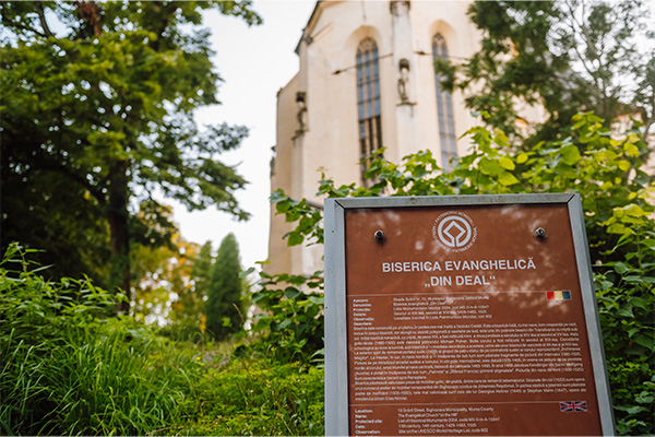
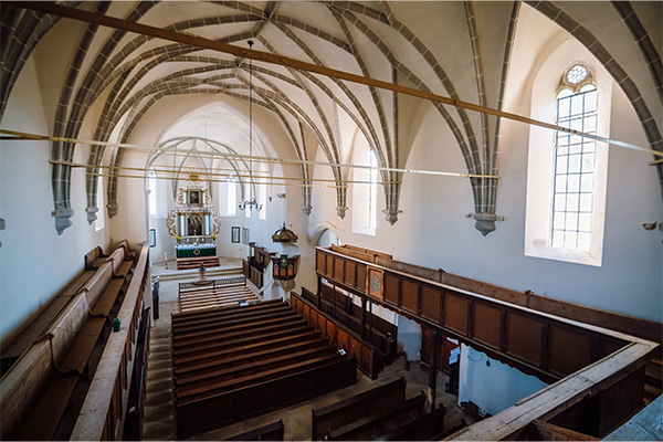
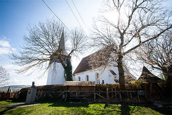
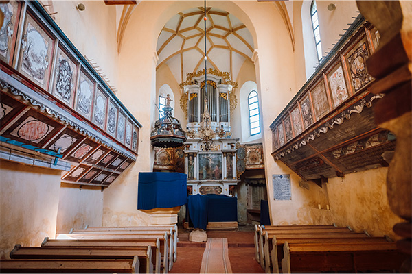
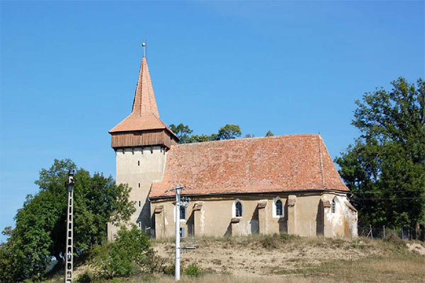
The Church on the Hill | Sighisoara City
[More about] [Map]
The Church on the Hill in Sighisoara was built in stages between 1345-1525. Dedicated to St. Nicholas, it is the third largest Gothic church in Transylvania. Located at 429 m, it is the fortress’s last defensive point. It contains Transylvania’s only known crypt beneath the choir, with tombs from the 16th-18th centuries. Painted fully inside and partially outside, 15th century murals were uncovered during 1992-2003 restoration. Highlights include a carved stone tabernacle and a pulpit from 1480. The organ dates from the 19th century.
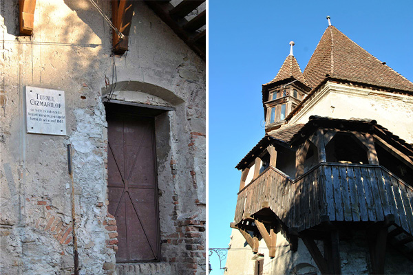
Cobbler’s Tower | Sighisoara City
[More about] [Map]
The pavement tower, mentioned in documents in 1522, was rebuilt in 1681 after the fire of 1676 and has the shape of a hexagonal prisms with uneven sides. The robust roof, with two observation towers on the south and north sides, gives it a special look. From this tower comes the stone tablet with the oldest coat of arms of the city and the motto Nomen Domini, turris fortissima” (translation: The name of the Lord is the most solid castle), which is preserved in the History Museum in the Clock Tower (in the German clock tower) in the city of Sighișoara (in German Schäßburg).
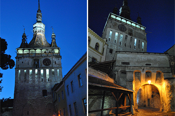
Clock Tower | Sighisoara City
[More about] [Map]
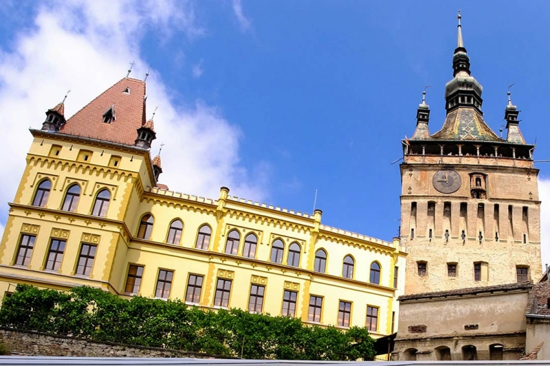
The Clock Tower is Sighisoara’s historic landmark and the largest of nine surviving defense towers of the original fourteen. Standing 64 m tall, it protects the southeast city gate and is visible throughout the center. Built in the 14th century, it was topped with a Baroque canopy in the late 17th century. Until 1556 it served as the town council’s seat. The 17th-century clock was restored in 1648, with wooden statues representing pagan gods of the days of the week. Its current mechanism was installed in 1906, made in Switzerland. It has two 2.4 m diameter dials.
Ugron Castle | Mures County
[More about] [Map]
Built between 1908 and 1912 for Baron István Ugron, the castle combines Neo-Gothic and Neo-Romanesque styles, resembling a medieval French castle. It was constructed with 365 windows, 4 towers, 52 rooms, 7 terraces, and 12 corridors following calendar symbolism. After nationalization, it housed various institutions. Currently owned by Mureș County Council, it can be viewed only from outside.
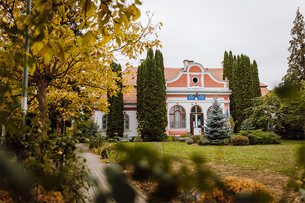
Rhedey Castle | Mures County
[More about] [Map]
The neo-baroque Rhédey Castle in Sângeorgiu de Pădure got its current form during 1807-1809 renovations. Birthplace of Claudia Rhédey, wife of Duke Alexander von Württemberg and great-great-great-grandmother of King Charles III. The restored castle houses the exhibition “Mysteria Residentiae Rhédey” and the tourist info center and an art exhibition downstairs. Opposite is the 13th-century Reformed church with historic renovations and the tomb of Claudia Rhédey.
Kemeny Castle | Mures County
[More about] [Map]
The settlement was owned by the Kemény family for 300 years. The two-story building with bastions at each corner gained its current shape between 1537-1557 and a late Baroque facade in 1818. In the interwar period it was a cultural hub hosting literary meetings. It was slightly damaged in WWII but heavily vandalized afterward. Since 2014, it has returned to the family and is open to the public again.
Bear Lake | Mures County
[More about] [Map]
Bear Lake in Sovata is the largest heliothermal lake in the world, with a salt concentration of 250 g/l. Formed in 1875 after heavy rain closed a sinkhole, it was originally called Illyés Lake but renamed Bear Lake due to its shape. Covering 4 hectares and 18 m deep, it is a popular summer destination. The temperature mechanism keeps deep salty water warm, earning it the nickname “Dead Sea of Transylvania.”
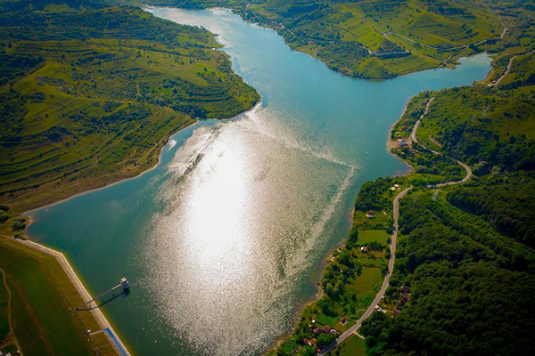
Lake Bezid | Mures County
[More about] [Map]
The Bezidu Nou reservoir was formed 1975-1990 by building a dam on the former village site, for flood control and city water supply. The capacity increased from 10 to 16 million m³, flooding the village and relocating its residents. Today the lake is a popular weekend spot. At the end is a Memorial Park with a mourning wall, old photos, a bell tower, and funerary sculptures, each symbolizing a house and preserving the village layout.
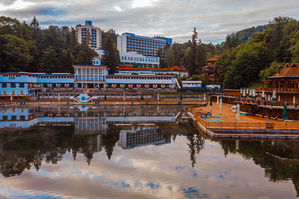
Sovata | Mures County
[More about] [Map]
Sovata’s fame grew with its healing waters, especially after building the first public baths (Géra Baths) in the 1840s. Aristocrats built summer villas such as Villa Sara and Villa Lola. After WWI, the Romanian Royal House visited for rest and treatment. At that time, Sovata had two hotels with 32 and 18 rooms, 74 villas with 417 rooms, two restaurants, a café, and a reading room. The resort operated from June 1 to September 30.
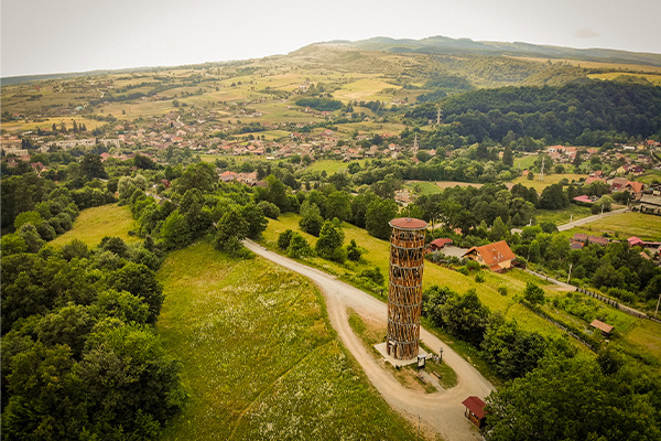
Belvedere Tower | Mures County
[More about] [Map]
The Belvedere Tower in Sovata is part of the path network around the salt lakes and arboretum in the Bear Lake Nature Reserve. Located at the end of Western Alley, it’s also accessible by car from Privighetorii Street. The free-to-visit tower is 28 m tall, and a spiral staircase leads to the top, offering 360-degree panoramic views of surrounding hills, villages, and the central, eastern, and northern parts of the town.
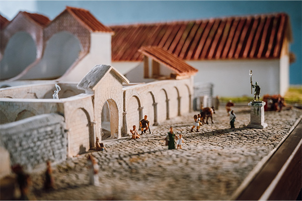
The Roman Limes archaeological site | Mures County
[More about] [Map]
The Roman site at Călugăreni was part of the limes defensive system, protecting Niraj Valley and Dacia province. Its exact location was established in the 19th century. Excavations revealed an auxiliary infantry unit, with command building, baths, and civilian houses. In 2015 the Archaeological Park was created, managed by the Roman Limes Research Centre. The park, covering over 5 ha, has TIME BOX pavilions presenting everyday Roman civil and military life and excavation info.
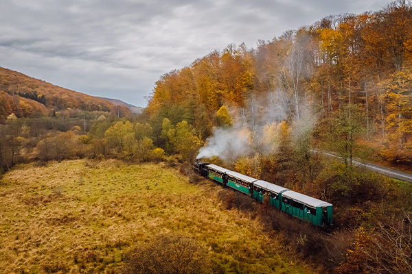
Mocanita Sovata – Câmpu Cetății | Mures County
[More about] [Map]
The Sovata steam train, built in 1949 in Poland, runs on the former narrow gauge railway linking Târgu Mureș and Praid, opened in 1915 and closed in 1997. Since 2011, the Sovata to Câmpu Cetății section is used for tourism. Visitors can enjoy a 14 km ride during summer, dine at trout farms, hike, or visit the Mini-Niraj Visitor Centre featuring a detailed model of the Niraj Valley and products from local producers.
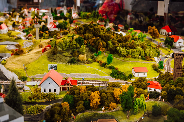
Câmpu Cetății & Mini Niraj Center | Mures County
[More about] [Map]
The village name probably comes from Fortress Hill above it, hidden in the narrow Niraj Valley. It is a popular tourist spot, known for traditional trout fried in cornmeal with garlic sauce. Surrounding forests offer hiking and cycling, narrow-gauge trains, hot-air balloon parades, and blueberry festivals. The Mini-Niraj Visitor Centre at the village entrance features a detailed model of the entire Niraj Valley and promotes its natural and cultural attractions.
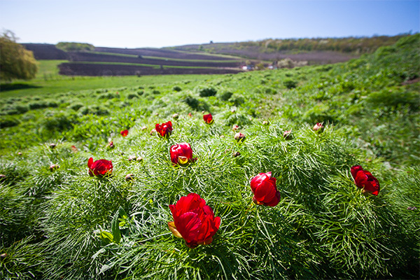
The steppe peony reserve | Mures County
[More about] [Map]
The Steppe Peony Reserve covers 3.49 hectares, home to 359 plant species including the Steppe Peony (Paeonia tenuifolia), which blooms May to June. It is Romania’s northernmost growing site for this protected species and a nature monument since 1932. The successful rescue is thanks mainly to Marcu Sâncrăian, who sowed seeds in molehills. Today visitors can admire tens of thousands of these flowers at the reserve.
Anton Badea Ethnographic Museum | Mures County
[More about] [Map]
The Anton Badea Ethnographic Museum, founded in 1960 with 64 household items and costumes, now has thousands of folk art and craft exhibits in the historic main building from 1892. Its beautiful garden simulates a miniature village with traditional houses, a wooden church, and folk technical installations. The institution offers many events and educational programs about local customs and crafts.
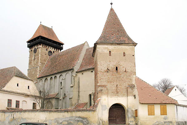
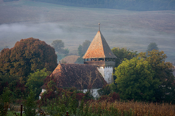
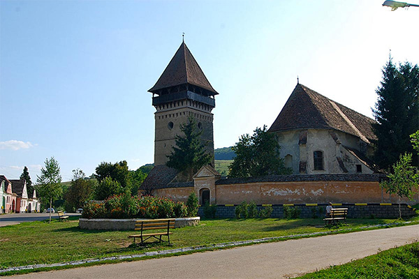
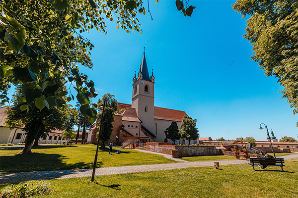
Fortified Church Saschiz | Mures County
[More about] [Map]
The fortified church of Saschiz (1493–1525) was built in late Gothic style on a former Romanesque basilica site. It features massive arches above buttresses, a defensive gallery over nave and chancel, and murder holes. The tower, built in 1832, stands 10 meters north of the church facade. The church has been a UNESCO World Heritage Site since 1999.
Fortress Saschiz | Mures County
[More about] [Map]
The Saschiz citadel was built in the 14th century to protect the village and surroundings. Constructed on Roman ruins by the local German-style community, it has an oval shape surrounded by 7-9m high walls, 4 corner towers, and 2 gate towers. Inside were two ponds and a 60m deep well likely linking to the village centre. This peasant fortress remains a key tourist attraction in Saschiz today.
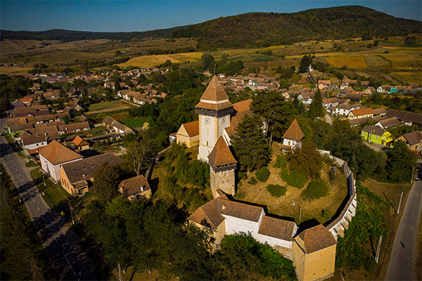
Unitarian Church Sanvasii | Mures County
[More about] [Map]
The village of Sânvăsii lies in the Niraj Valley, named after King Ladislaus I, mentioned in papal documents of 1332 as Sancto Ladislao. The Unitarian church on the eastern hillside likely dates from the 14th century, showing Gothic and Romanesque styles. Donated in 1580 by János Sügér, the chapel is from the 14th century, the tower from the 15th. The sanctuary’s frescoes from 1496 are noteworthy.
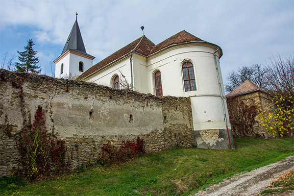
Fortified Church Apold | Mures County
[More about] [Map]
Situated 16 km from Sighisoara, the fortified evangelical church of Apold stands on a hill in the village center. Built originally in the 13th century as a Romanesque basilica, it was rebuilt in late Gothic style in the 15th century with an imposing western tower. The present complex was completed in the 15th-16th centuries. The clock tower has murder holes; a defensive gallery is above the chancel. The church is enclosed by double walls with towers and gate towers.
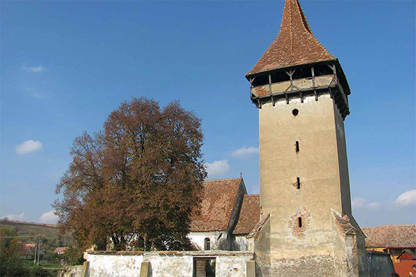
Fortified Church Archita | Mures County
[More about] [Map]
The fortified evangelical church of Archita is Mureș county’s largest. Built in the 13th century in Romanesque style, it was rebuilt in the 14th century in Gothic style. It features double walls with three corner towers each and a massive western tower from the 15th century. Restored in 2011, its clock was repaired in 2020. The church is a popular visitor attraction nestled in gentle hills near Sighisoara.
Fortified Church Cloasterf | Mures County
[More about] [Map]
Cloașterf hosts one of Transylvania’s most cohesive fortified churches, built 1521-1524 by master Ștefan Ungar. Designed as a fortress church against firearms, it is surrounded by defensive walls with corner towers. Inside, an 18th-century tri-sided gallery features floral motifs and paintings showing other fortified churches.
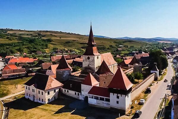
Fortified Church Bagaciu | Mures County
[More about] [Map]
The gothic fortified church is likely the third church, on the place on which it sits. It was likely built in the early 15th century, and then fortified around 1500. It has a very high ceiling, and is in good shape for the most part. Its bell tower / donjon is also huge, compared to other fortified churches. It used to have one more tower in the north-east. Bagaciu became rich during the middleages, mainly of its surplus of wine.
Fortified Church Batos | Mures County
[More about] [Map]
Significant parts of today’s church originate from a Gothic church whose first construction phase dates back to the 14th century. The side aisles speak for this dating, suggesting that the church was originally a basilica. In addition, a parish priest in Batoș was first mentioned in a document as early as 1332. A major fire considerably damaged the church in 1728. Less damage was done to the bell tower built in 1638 in the southeast of the church.
Fortified Church Daia | Mures County
[More about] [Map]
A Gothic hall church was built in the first half of the 15th century. A keystone in the cross-ribbed vault of the choir bears the year 1447 marking the end of this construction phase. The choir and hall are buttress-supported. The vault ribs rest on richly moulded wall consoles. The church has two-part Gothic traceried windows. At the beginning of 16th century, a tower was built in the west wing of hall and an arch-supported defence storey above the choir. This mounted choir was demolished in 1896.
Fortified Church Hetiur | Mures County
[More about] [Map]
Inside the small village a hall church was erected in the 15th century, its chancel being closed by a polygonal construction. A tower with defence level and spire was built on the western side of the today standing Gothic church. As suggested by the buttresses, the interior of the church was most probably covered with vaults, which were later on replaced by a flat ceiling. Only ruins are preserved from the defence wall.
Fortified Church Ideciu de Jos | Mures County
[More about] [Map]
A fire destroyed the old church of Ideciu de Jos in 1868. Reconstruction began in 1870, but open-air services were still being held until 1874. The congregation sat in a large circle on rafters, which were later to support the tower roof. The newly built hall church does not show any particular stylistic features: The room is divided into three vaulted bays separated by belted arches, the choir has a lunette vault and between the choir and the nave there is a round triumphal arch.
Fortified Church Ideciu de Sus | Mures County
[More about] [Map]
In the 15th century, a small Gothic hall church was built in Ideciu de Sus, consisting of a hall and a rectangular closed choir. The church received its present appearance with a flat, slightly rounded wooden ceiling in 1861. Its windows are large, wide and round closed. In the north and west there are wooden porches, the west portal has a pointed arch. In front of the southern entrance, there is a vestibule and a wide, round triumphal arch connects the choir and the nave.

Fortified Church Idiciu | Mures County
[More about] [Map]
The small hall church was built in the 15th century on a mountain ridge in the west of the community of Idiciu. In consequence of a storm in 1690, the vault collapsed. Between 1825 and 1827 a larger choir took the place of the medieval one due to alteration works by Conrad, a master builder from Mediaș. Major renovation work was carried out in 1904, including the installation of a new roof truss. In 1927 the old wooden belfry was taken down and a new bell tower was built on the west side.
Fortified Church Magherus | Mures County
[More about] [Map]
On the valley slope, halfway up the hill above the village, stands the simple hall church of Magheruș. Free of certain stylistic features, it was probably built in the 16th century. The bell tower is made of massive stone masonry and is significantly older than the church. This assumption is supported by the narrow, long firing slits, which date back to before the appearance of firearms. From the third floor the tower is made of brick masonry, the fifth floor forms the open battlement on hanging trestles.
Fortified Church Nades | Mures County
[More about] [Map]
A complaint to the Pope in 1309 casually mentions that the church of Nadeș is dedicated to St. Martin. In the second half of the 15th century, the church underwent major reconstruction. The nave was demolished around 1850 and a Neo-Classical new building was erected on this site by Samuel Teutsch until 1853, whose vaulting breaks through the eastern side of the defensive wall.
Fortified Church Ormenis | Mures County
[More about] [Map]
The village of Ormeniș was first mentioned in documents in the year 1319. It is part of the so-called “Kokelburger Komitat”, a kind of province or administrative area. Ormeniș belongs to a group of 13 villages from the region that made efforts to win a trial against their landlords in the 18th and 19th century as they felt their traditional freedom and rights were not being respected.
Fortified Church Saes | Mures County
[More about] [Map]
After the collapse of the original Romanesque church in Şaeș in 1802 the ruins were entirely removed and replaced with a neo-classical hall church with narrowed chancel and western bell tower, completed in 1820. The facades of tower and church show a subtle composition of pilasters and cornices. A pyramid roof covered with color glazed tiles caps the tower. On top of the pyramid a lantern is placed covered with metal sheets and decorated with garlands made of metal.
Fortified Church Seleus | Mures County
[More about] [Map]
The village is situated in a right side valley of the Tarnava Mare river. At the intersection of three streets in the center of the village stands the fortified church. Originally, the villages of Seleuș, Hoghilag, Laslea, Duneș and Prod were on the grounds of a monastery, but towards the end of the 14th century Seleuș became a free municipality of the See of Sighișoara. The church dedicated to St. Ladislaus is mentioned in documents in 1476. It has a cross-rib vaulted choir with polygonal end and buttresses.
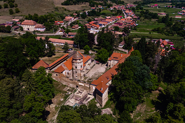
Bethlen Castle Cris | Mures County
[More about] [Map]
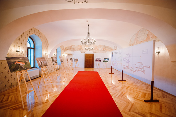
The Renaissance-style Bethlen Castle in Criș dates from the 15th century, founded by Márk Bethlen. Its striking arched wing was probably added in 1559. The five-level cylindrical Archers’ Tower is the oldest, built defensively. The richly decorated ensemble is among Transylvania’s most significant Renaissance civil buildings. The Bethlen family lived here until between the world wars; the castle was nationalised. In 2007, the heirs regained it and entrusted it to a foundation for restoration.
Bethlen Castle Bahnea | Mures County
[More about] [Map]
Bethlen Castle in Bahnea was built starting in 1545; between 1679 and 1719 it was fortified with stone walls, octagonal bastions, and gate towers. It combines Romantic style and Neo-Renaissance carpentry, with 42 rooms on three levels. During communism it housed public institutions, but deteriorated after 1989. In 2008 it was restituted to heirs, who later donated it to the Reformed Church.
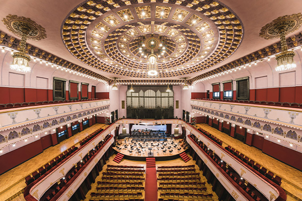
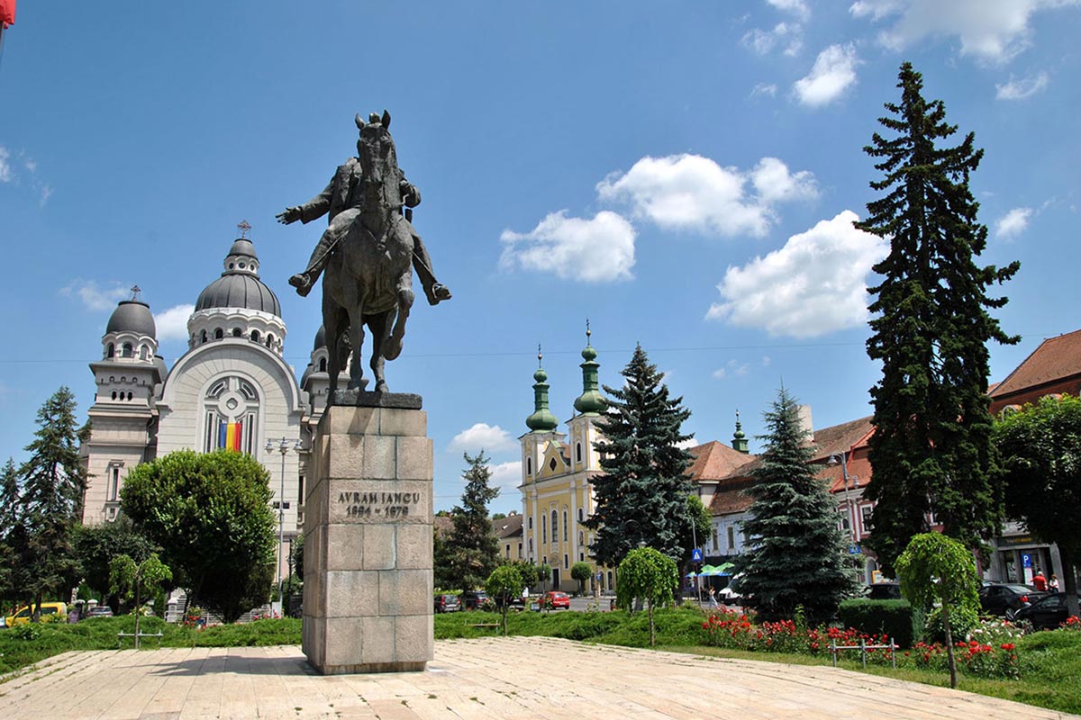
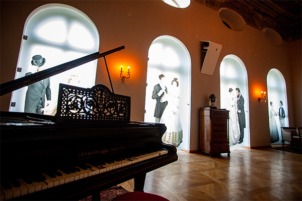
Palace of Culture | Targu Mures City
[More about] [Map]
Built between 1911 and 1913 at the initiative of Mayor Bernády György, the Palace of Culture is one of the finest examples of Secession style in Transylvania. Architects Komor Marcell and Jakab Dezső, who also built the Town Hall, decorated it with frescoes, mosaics, and stained glass. Inside are the foyer, concert halls, and Hall of Mirrors. Today it hosts the county library, art galleries, and the state philharmonic.
The Medieval Fortress | Targu Mures City
[More about] [Map]
The medieval fortress was built in the 17th century on the site of a 1492 fortification. Destroyed in 1601, rebuilding began in 1602 led by town judge Borsos Tamás as a pentagonal fortress with seven bastions. In 1616, it gained free royal town status. Restoration started in 2011, making it a key attraction for locals and tourists.
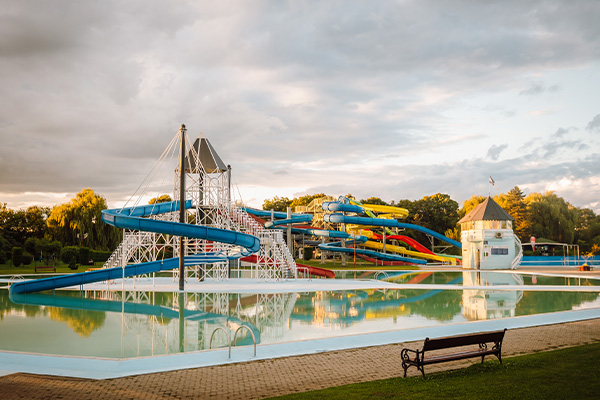
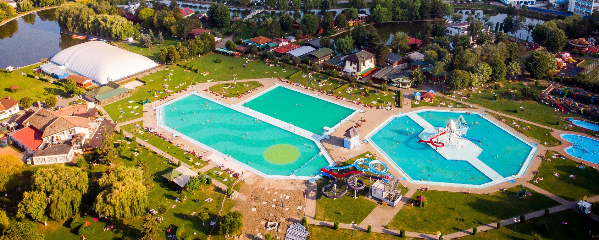
Complex “Weekend” | Targu Mures City
[More about] [Map]
The “Mureșul” leisure and sports complex, called “Weekend” by locals, is the busiest summer destination in Târgu Mureș, covering about 40 hectares. It includes swimming pools of various sizes, natural grass beaches, food and drink terraces, sports fields, and even a boating canal cut off from a former branch of the Mureș River.
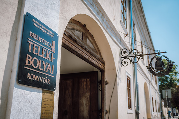
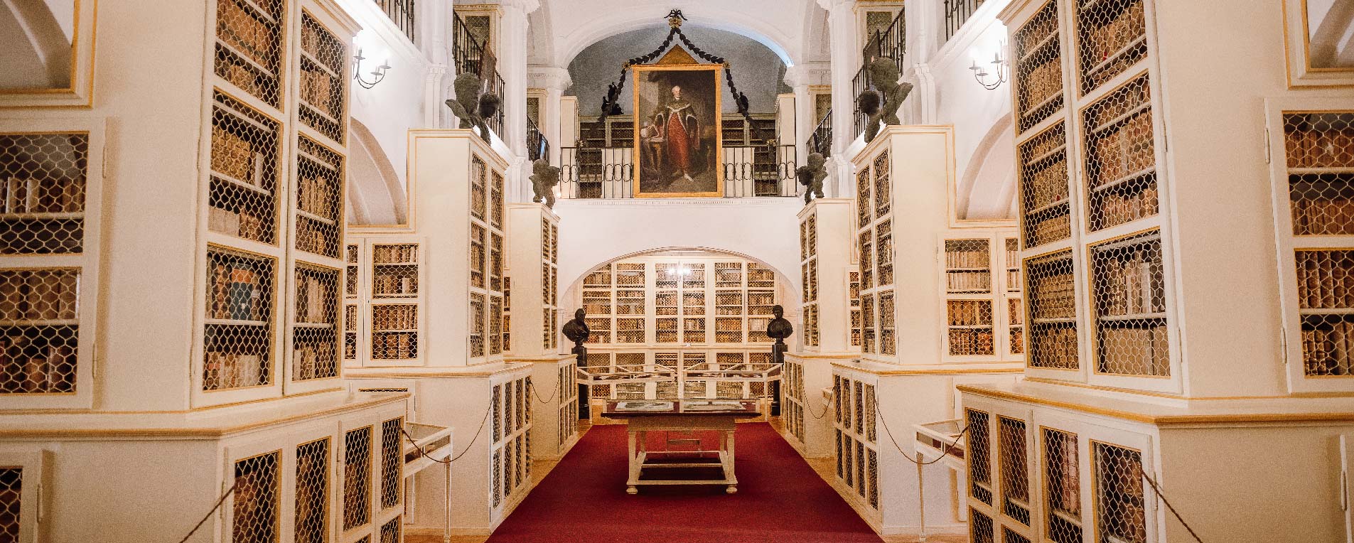
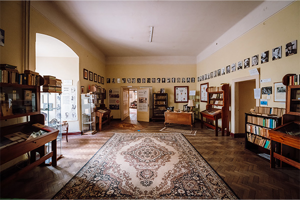
Teleki Library | Targu Mures City
[More about] [Map]
In 1802 Count Teleki Sámuel, Chancellor of Transylvania, opened the first public library in the region. The building was constructed between 1799 and 1802 and housed about 40,000 volumes of important scientific works plus a reading room. After World War II, the collection was expanded by 80,000 volumes from the former Reformed College and other sources. Today the treasures of Teleki Library can be admired in the ground floor hall.
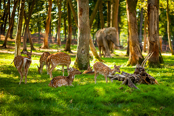
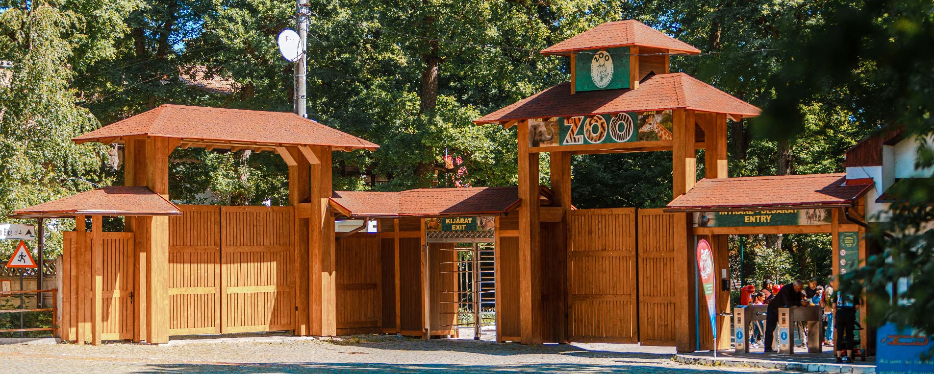
Cornești Plateau & Zoo | Targu Mures City
[More about] [Map]
Cornești Plateau is a popular summer retreat offering shady walks, playgrounds, the city’s largest skatepark, a narrow-gauge train, and a running track. Established in the 1960s on a small area, the Zoo now spreads over 42 hectares with more than 800 animals from 150 species. It is the largest zoo by area in the country and the only one to have elephants, giraffes and gibbons.

International Airport Transilvania | Târgu Mureș
[More about] [Map]
The airport offers quick and convenient access to numerous tourist destinations in Romania, making it an ideal starting point for those who want to explore the country’s beauty. Thanks to its modern infrastructure and efficient connections, travelers can easily reach different regions. The airport is therefore the gateway to unique natural landscapes, cities steeped in history, heritage monuments, and a variety of authentic experiences.
Facebook PostsView all Facebook posts!


